LiDAR stories

Scanabull raises NZD $1.1 million for cattle weighing tech
Last month
#
agricultural technology
#
edge computing
#
supply chain
New Zealand agritech startup Scanabull raises NZD $1.1 million to scale smartphone-based 3D cattle weighing for beef farmers.

Fathom deepens AXA Climate tie-up for flood risk data
Last month
#
supply chain
#
risk & compliance
#
ai
Fathom has deepened its partnership with AXA Climate's Altitude platform to embed richer probabilistic flood and terrain data for investors.

Emesent unveils GX1 scanner to speed up site surveys
Thu, 19th Feb 2026
#
productivity
#
engineering
#
skills shortage
Emesent launches GX1 mobile scanner, promising survey-grade accuracy and site survey times slashed by up to 95% for construction teams.
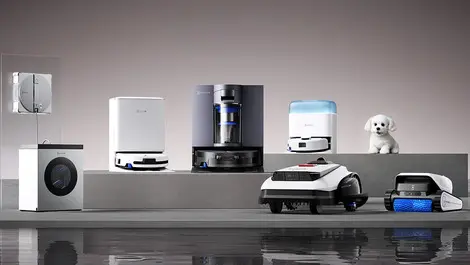
ECOVACS debuts full-scenario home robots & LilMilo at CES
Tue, 13th Jan 2026
#
robots
#
edge computing
#
smart home
ECOVACS launches full-scenario home robots at CES, unveiling new DEEBOT, GOAT, WINBOT and ULTRAMARINE lines plus LilMilo pet bot.

Roborock unveils AI stair-climbing robot & Real Madrid deal
Tue, 13th Jan 2026
#
iot
#
smart home
#
ai
Roborock debuts an AI stair-climbing Saros Rover at CES and kicks off a multi-year global partnership with Real Madrid Football Club.

Bigmate deploys AI quality platform on Equinix in Sydney
Tue, 9th Dec 2025
#
devops
#
hybrid cloud
#
digital transformation
Bigmate has launched its ACIS AI quality platform on Equinix infrastructure in Sydney, targeting global growth in industrial automation.

Revolutionary SuperPac aircraft debuts in Australia tour & race
Tue, 5th Aug 2025
#
clean technologies
#
climate change
#
united nations
The SuperPac 750XL-II, a revolutionary short take-off aircraft, debuts in Australia, touring ahead of the 2025 Outback Air Race supporting the RFDS.
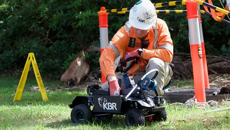
Central Coast Council deploys remote vehicle for record sewer scan
Thu, 12th Jun 2025
#
lidar
#
3d scanning
#
public infrastructure
Central Coast Council used a remote-controlled vehicle with LiDAR and 360° CCTV to scan a 640m sewer stretch, enhancing safety and efficiency in inspections.
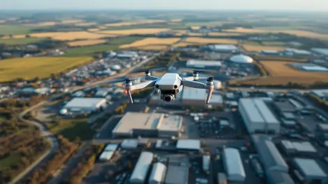
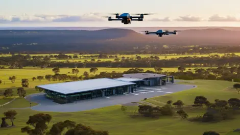
Commercial drone automation set to soar across industries
Fri, 23rd May 2025
#
agricultural technology
#
surveillance
#
edge computing
A Forrester report finds 78% of automation leaders plan to implement aerial drone automation within a year, boosting efficiency across industries.

Osmose & Neara partner to enhance utility data accuracy
Thu, 27th Mar 2025
#
data analytics
#
lidar
#
predictive analytics
Osmose and Neara have partnered to enhance utilities' asset risk assessments, aiming for improved grid resilience and significant cost savings.
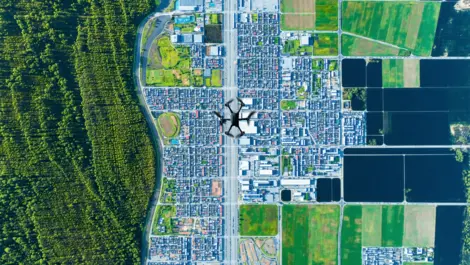
Drone GIS mapping market grows with tech advancements
Fri, 24th Jan 2025
#
agricultural technology
#
construction
#
geographic information system
The global drone GIS mapping market is poised for significant expansion, fuelled by technological advancements and increasing demand across diverse industries.
Carbonix partners with Toll to enhance drone operations in Australia
Wed, 2nd Oct 2024
#
uc
#
drones
#
collaboration
Carbonix has partnered with Toll Uncrewed Systems to bolster drone operations and training in Australia, enhancing capabilities across various sectors.
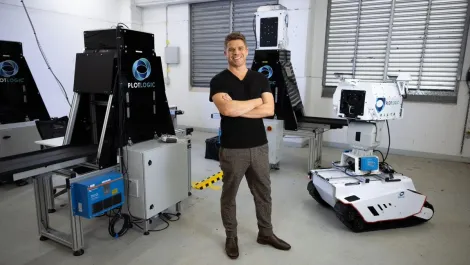
Australian tech firms spearhead mining efficiency & sustainability
Wed, 7th Feb 2024
#
semiconductors
#
ai
#
clean technologies
Small Australian tech firms, including innovators Plotlogic and global drone solutions, drive sustainable innovation and efficiency in global mining; key players in the industry's 'race to net-zero'.

SA Power Networks completes world-first with extreme weather response
Thu, 11th May 2023
#
weather
#
aras
#
lidar
SA Power Networks has used state-of-the-art technology to inform, manage and accelerate its response to the River Murray flood event.

Neara launches a new automated LiDAR classification solution
Fri, 3rd Feb 2023
#
clean technologies
#
productivity
#
sustainability
The new solution offers LiDAR (Light Detection and Ranging) based insights into critical infrastructure 30 times faster than manual processing.